Thump, thump! The thumping of feet on rock can be heard under our feet.
Our movement effect is low. We need charging.
A few thumps later: We’re sitting around a campfire site.
The sweet hot chocolate milk is filled with energy.
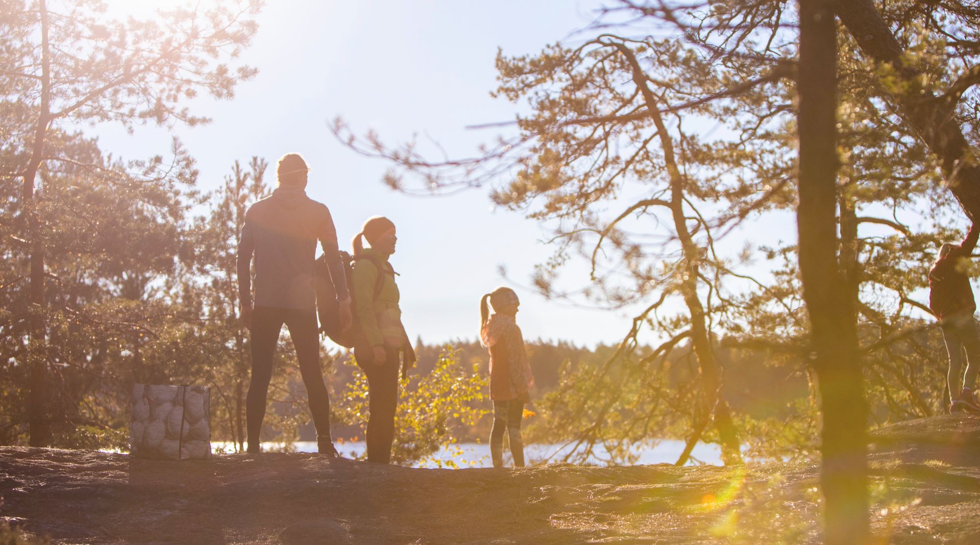
The high cliffs, the maritime views and the well-maintained campfire sites of Porkkalanniemi calls hikers into nature. The majestic cliffs, the pine trees, the numerous species of birds and the fantastic sea views are typical sightings in Porkkalanniemi. The cooking shelters are right near the parking areas, and thus even families with children have an opportunity for outdoor recreation. Making a fire is only allowed at specifically marked constructed campfire sites. At times when there is risk of wildfire, making a fire is only allowed in cooking shelters. The destination is also suitable for winter hiking as the roads and parking places in the area are cleared of snow during the winter.
The Vetokannas trail (2.1 km)
The Vetokannas trail starts in northern Porkkalanniemi and leads to the west of Telegrafberget. The route is accessible (no winter maintenance), and there are several cooking shelters and outhouses along the route. The sea view and Bronze Age burial mounds are among the attractions of the Vetokannas trail.
Parking: Tullandintie 38, 02480 Kirkkonummi (location on the map)
Route: The route marking is red. The end of the route is shared with the Teleberget trail (yellow marks).
Campfire sites and outhouses: The Tiira, Koskelo and Lokki cooking shelters and outhouses, and Haahka campfire site and outhouse are along the route.
Accessibility: The destination is not accessible for persons with mobility disabilities.
The Telegrafberget trail (2.2 km)
The Telegrafberget trail is an accessible circular route that goes around the Telegrafberget hill (no winter maintenance). You can start walking the route from three different parking areas, and along the route, there are several cooking shelters and outhouses. The attractions of the path are the numerous lookout points over the sea. It is possible to combine the route with the Vetokannas trail and the Pampskatan trail.
Parking:
- Porkkalan portti: Tullandintie 187, 02480 Kirkkonummi (location on the map)
- Hirviniitty: Omsatuntie 16, 02480 Kirkkonummi (location on the map)
- Haahka: Omsatuntie 76, 02480 Kirkkonummi (location on the map)
Route: The route is marked in yellow. The Pampskatan trail and the Vetokannas trail are marked in red.
Campfire sites and outhouses: The Lokki cooking shelter and outhouse, Haahka campfire site and outhouse and the accessible outhouse at Haahka are along the path.
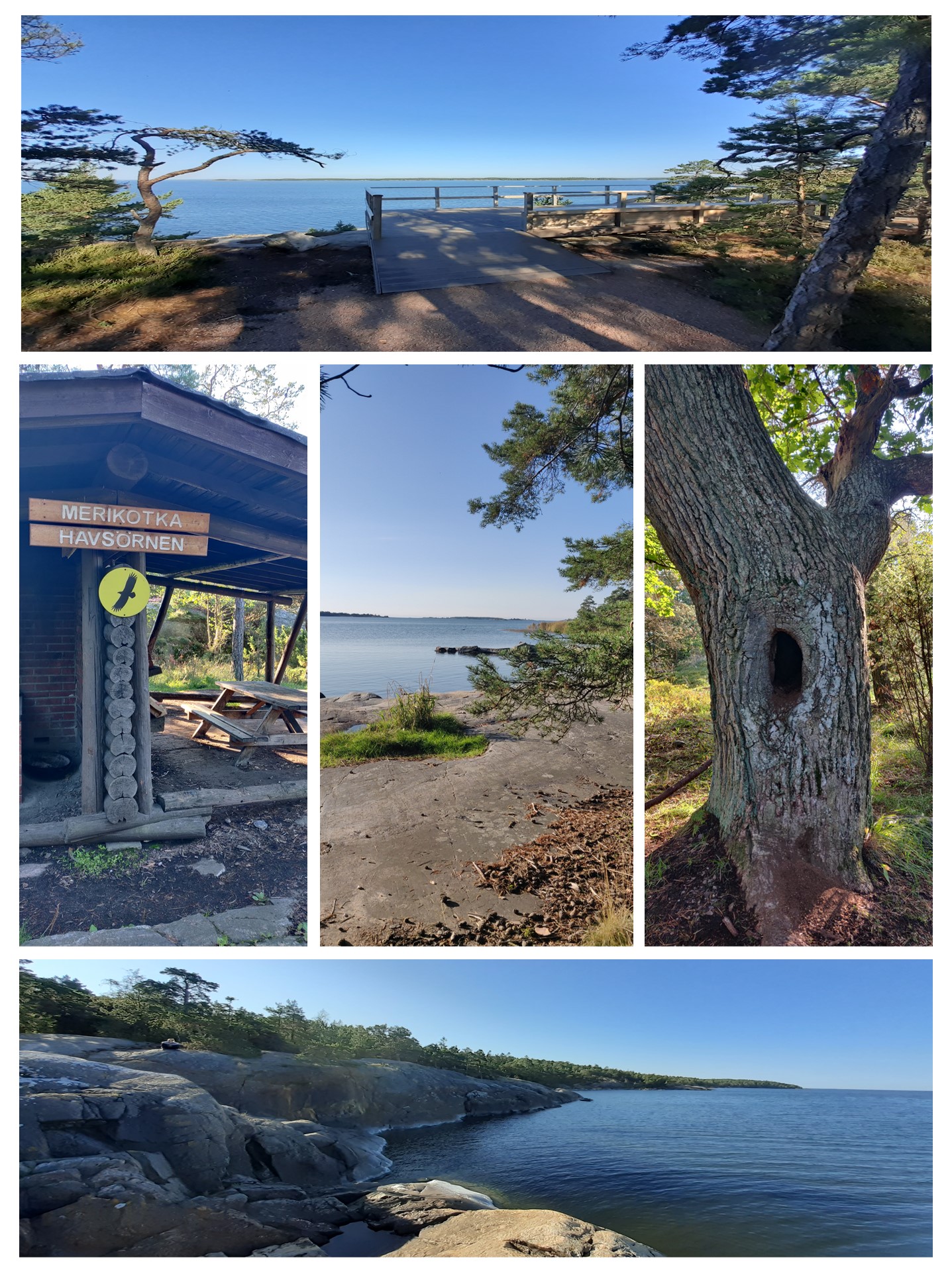
Accessibility: Near the Haahka parking area, there is an accessible viewing platform with an entrance to the road. It is about 100 metres from the parking area. There is also an accessible outhouse near the parking area. The Haahka campfire site is not in itself accessible for people with mobility disabilities.
The Pampskatan trail (1.4 km)
The Pampskatan trail leads the hiker to the southernmost part of Porkkalanniemi, Pampskatan, which is only 36 kilometres away from the north coast of Estonia (no winter maintenance). The terrain is accessible except for the climb at the southern end of the route. Along the route, there are several cooking shelters and outhouses. You can admire the fantastic sea view from the tip of the headland.
Parking: Tullandintie 187, 02480 Kirkkonummi (location on the map)
Route: The route is marked in red
Fire sites and outhouses: The Merikotka cooking shelter, outhouse and campfire site are at the southern end of the route
Accessibility: The destination is not accessible for persons with mobility disabilities.
Play a game
Photographer
Make different frames with your body and look through the frame. What’s in the picture? You can, for example, make frames with your fingers or arms or by glancing back through your legs. What’s in the adult’s picture? And in the child’s picture? It’s important that the adult positions him- or herself at the level of the child to look.
Tip: You can take a picture of the view in the frame for real. Why did you want to take a picture of this particular view?